
Understand Existing
Assets With Confidence
Know what exists before you invest.
Northwest Precision Studio offers reliable visual and spatial documentation services for existing properties, residences, and structures, as well as for project teams — assisting clients in minimizing uncertainties prior to planning, coordinating, repairing, or investing.
Existing Spaces
Often Come With
Uncertainty
Existing assets often come without fully reliable documentation. Plans may be outdated, records incomplete, and measurements missing. This uncertainty can become the main obstacle before any decisions are made.
Missing or Outdated Documentation
Existing plans, drawings, and records that do not accurately represent the current situation or were never produced in the first place.
Incomplete Records That Can't Be Trusted
Incomplete documentation with missing information, leading to risks at every decision stage from planning to execution.
Uncertainty Before Major Decisions
Lack of dependable spatial data prevents effective planning, coordination, or investment in your existing spaces.
The Cost of
Uncertainty
When the existing-space documentation is absent, outdated, or incomplete, the cost extends beyond the record itself — it impacts every decision relying on it.
Projects Delayed
Waiting for dependable spatial information that should be available but isn't.
Designs Built on Assumptions
Drawings created based on unverified conditions rather than confirmed measurements.
Bids Based on Guesswork
Estimates and proposals made without a clear record of existing conditions.
Decisions Without a Record
Property and project decisions made without supporting documentation.
Conversations Without Support
Addressed repair, restoration, and documentation needs without providing visual records.
A Disciplined
Documentation Process
Each project adheres to a consistent, consultative workflow — starting with understanding your goals and ending with delivering actionable documentation. This process helps minimize uncertainty at every stage.
Scope
Gain a clear understanding of the property, its objectives, and documentation requirements.
Capture
Conduct a professional field capture to generate the visual and spatial documentation.
Organize
Transform captured information into organized documentation.
QA/QC
Assess the deliverables to ensure clarity, consistency, and usefulness.
Deliver
Package and deliver the information in a manner that enables clients and project teams to utilize it effectively.
Scope
Gain a clear understanding of the property, its objectives, and documentation requirements.
Capture
Conduct a professional field capture to generate the visual and spatial documentation.
Organize
Transform captured information into organized documentation.
QA/QC
Assess the deliverables to ensure clarity, consistency, and usefulness.
Deliver
Package and deliver the information in a manner that enables clients and project teams to utilize it effectively.
The Core
Capture Package
A professional LiDAR reality capture visit produces an interactive visual and spatial record of the existing building, home, or space — serving as the basis for all subsequent documentation and deliverables.
CORE CAPTURE ESTABLISHES THE RECORD. DOCUMENTATION DELIVERABLES RENDER THE RECORD ACTIONABLE.
The Core Capture Package serves as the foundation. Quotes for Documentation Paths and Project-Specific Documentation Deliverables depend on project scope, property size, complexity, type of deliverable, availability, intended use, and turnaround time.
Choose the Right
Documentation Path
Core Capture lays the foundation, while Documentation Paths transform this captured information into practical project records, planning tools, and technical files, tailored to their intended use.
Property Record Package
Homeowners, Property Owners, & Realtors
For long-term records, repair documentation, and insurance-related visual records where appropriate.
Remodel Planning Package
Homeowners, Designers & Contractors
For those preparing for remodels, additions, repairs, or renovations.
AEC Coordination Package
Architects, Engineers & Contractors
For project teams that need existing-space information for planning, coordination, and documentation workflows.
Facility Record Package
Building Owners & Facility Teams
For building owners, facility teams, and long-term building documentation.
Documentation Paths and Project-Specific Documentation Deliverables are quoted based on project scope, property size, complexity, deliverable type, availability, intended use, and turnaround needs.
Project-Specific
Documentation Deliverables
Certain projects need particular outputs. You can choose these deliverables individually or combine them into a Documentation Path, which is scoped and quoted according to your project's requirements.
Floor Plan Documentation
Clean plan-style documentation that helps clients understand layout, room relationships, and spatial organization.
CAD File / 2D CAD Documentation
A 2D CAD-style file deliverable that can support planning, coordination, and downstream project conversations.
BIM / Model File Package
A model-based deliverable for appropriate projects where a 3D building-information file can support planning, coordination, and project understanding.
Technical Data Assets Package
A technical file package for AEC and project teams that need supporting spatial data and project-reference assets from the captured space.
Point Cloud Export
A point cloud export for technical teams that need spatial data for compatible software workflows.
Sketch File for Estimating / Insurance-Related Documentation
A sketch-style documentation file that may support estimating, repair documentation, restoration conversations, or insurance-related documentation needs where appropriate.
Public Mapping / Street View Publishing
A publishing option for select commercial or public-facing spaces where online visual access may support visibility and navigation.
Quoted based on project scope, property size, complexity, deliverable type, availability, intended use, and turnaround needs.
Who We Help
Whether you are a property owner or a member of a project team, our resources are invaluable for individuals seeking to understand their space with confidence prior to commencing work.
Building Owners
Need reliable information before renovation, maintenance, leasing, sale, asset planning, or long-term building decisions.
Homeowners
Need clear documentation for remodels, additions, repairs, property records, insurance-related visual documentation, or understanding their home before investing in work.
AEC Project Teams
Architects, engineers, contractors, designers, consultants, and project teams that need dependable existing-space information before planning, design, coordination, renovation, or construction.
Facility Teams
Teams responsible for maintaining, operating, documenting, and planning existing buildings and spaces over time.
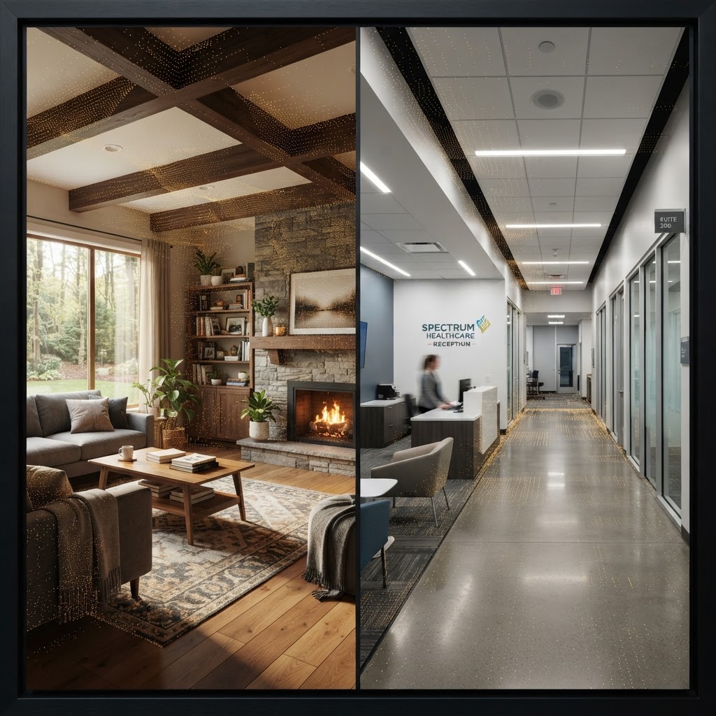
From single-family homes to complex commercial environments
Serving residential property owners and professional teams alike — Building Intelligence & Existing Conditions Documentation for homes, buildings, and project teams.
Experience Across
Complex Building Types
Familiarity with building types developed through experience in architectural projects across residential, commercial, industrial, and regulated settings.
Complex / Regulated Environments
- ◆Healthcare
- ◆Biopharmaceutical
- ◆Biotechnology
Industrial / Operational Facilities
- ◆Manufacturing
- ◆Warehouse & Industrial
Commercial / Building Contexts
- ◆Commercial Office
- ◆Mixed-Use Facilities
- ◆New Buildings
- ◆Existing Buildings
- ◆Renovations & Retrofits
Residential / Property Contexts
- ◆Single-Family Homes
- ◆Townhomes
- ◆Condominiums
- ◆Apartments / Multifamily
- ◆Remodels & Additions
Familiarity with building types reflects experience in Architecture, Engineering, and Construction (AEC) projects. Northwest Precision Studio does not offer licensed architectural, engineering, or surveying services.

Why Northwest
Precision Studio
Professional LiDAR reality capture offered through a structured service model, with expertise in building types and a practical understanding of how existing-space documentation is utilized in real-world applications. Based in Washington State, serving the Pacific Northwest.
Professional Project Background
Familiarity with the processes involved in the design, documentation, and construction of buildings, as well as understanding how owners, homeowners, Architecture, Engineering, and Construction (AEC) teams, contractors, designers, and facility management teams utilize existing space documentation in practical applications.
Building-Type Familiarity
Experience spanning complex commercial, industrial, regulated, and residential buildings — including healthcare, biopharmaceutical facilities, warehouses, mixed-use developments, and single-family homes.
Outcome-Focused Service
We assist in clarifying how to use the record, not merely providing the file. We communicate clearly about what was recorded and how it aligns with your objectives.
Structured Service Model
A straightforward starting point — the Core Capture Package — is followed by Documentation Paths and Project-Specific Documentation Deliverables. It offers a logical flow from capture to actionable documentation, eliminating guesswork.
Ready to
Understand
Your Space?
Schedule a consultation or send us a message. We'll respond promptly to discuss your property, project, and documentation goals.